


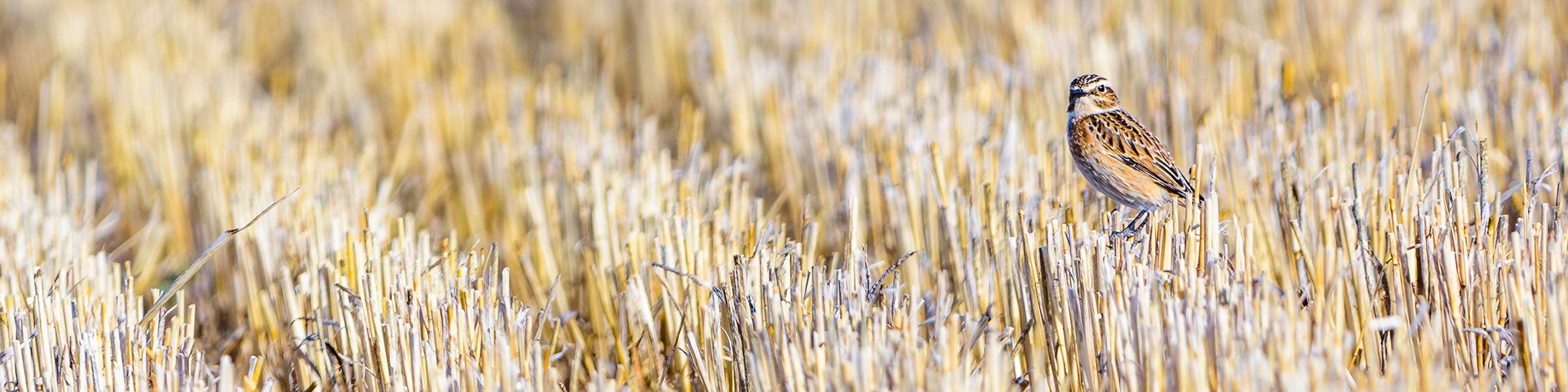
Farmland biodiversity is essential for healthy ecosystems and productive agricultural landscapes. However, in Europe, farmland birds, which are key indicators of environmental health, have declined sharply due to intensified farming. In eastern Germany’s Brandenburg, two satellites perform tasks beyond the capacity of numerous ornithologists. The EU’s Sentinel-2 satellites capture high-resolution images every few days, updating Europe’s agricultural landscape. Dr. Annett Frick, leading Remote Sensing at LUP, has converted this data into a conservation tool over the past three years.
Through the EU-funded BirdWatch project, Frick’s team, managed by the European Union Agency for the Space Programme, developed a system using satellite data and AI to evaluate farmland habitats for birds and pinpoint effective conservation measures.
Urgency is critical. The Pan-European Common Bird Monitoring Scheme reports a 19% decline in common European bird populations since 1980, with farmland species like yellowhammers and turtle doves declining by up to 58%. This downturn reflects decades of agricultural intensification, replacing diverse landscapes with monoculture crops, reducing wildlife habitats. Frick warns that declining farmland birds indicate many agricultural landscapes aren’t functioning healthily.
Farmland birds, as umbrella species, reveal ecosystem health. If conditions suit these birds, they typically suit other plants and animals, benefiting wildlife conservation and people. Healthy ecosystems maintain fertile soil, support pollinators, regulate water, and protect against pests and disease. Biodiversity protection is a focus of European environmental policy, with the EU Biodiversity Strategy for 2030 aiming to restore ecosystems and increase high-diversity landscape features on agricultural land. The Birds and Habitats Directives offer a legal framework for protecting vulnerable species and habitats.
Achieving these goals requires precise information on biodiversity, pressure points, and beneficial interventions. The BirdWatch initiative, concluded in January 2026, aimed to provide this. Traditional conservation assessments involve field surveys, but they are time-consuming and costly on large scales. Frick states past efforts lacked necessary spatial scale.
The BirdWatch team used Sentinel satellite data and habitat suitability models to create a larger agricultural landscape picture. Satellite imagery offered details on canopy cover, crop types, and land uses like grasslands, forests, and urban areas. Local land-use data refined this information. Radar observations from Sentinel-1, which passes over Europe every six days, estimated soil moisture.
Dr. Bartolomeo Ventura from Eurac Research, part of the BirdWatch team, explained that radar can identify water-rich areas, aiding detailed maps of soil moisture variation across landscapes. The resulting data on crop cover, vegetation structure, land use, and moisture combined with habitat models for ten indicator farmland bird species to assess where conditions are suitable or could be for each species.
The BirdWatch platform identifies habitats and where resources can deliver the highest ecological return. An AI-powered optimization system lets users test conservation scenarios and budgets to identify measures likely to improve bird habitats. Options include planting hedgerows, converting arable land to pasture, and diversifying crop rotations. The system was tested in pilot regions: Brandenburg, Germany; Flanders, Belgium; Lithuania; and South Tyrol, Italy.
In Brandenburg, researchers tested conservation strategies with a hypothetical €1 million budget, focusing on protected areas and priority sites across the region. Local knowledge proved key, as regional habitat conditions vary widely, and bird species adapt locally, making continent-wide models insufficient.
Today, the BirdWatch platform is publicly accessible, offering habitat suitability maps and conservation scenarios for pilot regions. Authorities and conservation groups across Europe are interested in adapting the approach. This work supports the EU Biodiversity Strategy for 2030, which aims to halt biodiversity loss and restore ecosystems, targeting at least 10% of agricultural land to have high-diversity features.
The challenge is significant. In Brandenburg, almost half the land is agricultural, yet a study found 94% of farmland doesn’t meet the 10% target. BirdWatch helps identify where conservation efforts can be most effective, guiding resource allocation. Frick sees the project’s major achievement in demonstrating how modern Earth observation can aid biodiversity planning at an unprecedented scale.
“Our biggest achievement was showing spatial optimization works at scale, across millions of parcels, in real landscapes,” said Frick. “We can see, for the whole of Germany, for every field, whether conditions suit the birds we want to protect. And for most of them, they are not.”
Research in this article was funded by the EU’s Horizon Programme. Views of the interviewees don’t necessarily reflect those of the European Commission.









Leave a Reply